
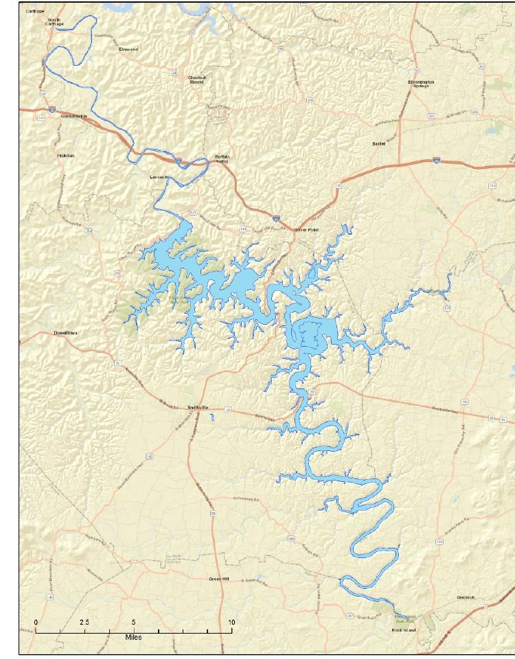

Water route · Road route
A boat map and a road map tell different stories
From the water, a point across the cove may be minutes away. By car, that same trip can mean climbing out of the hollow, following a ridge, finding the right bridge and coming back down another road. The blue gap looks small because the difficult part is the land around it.
I always check the exact driving route to the exact ramp, marina, trailhead or restaurant. “Near the lake” is a regional description. It is not a travel time.
Groceries · Fuel · Food
Smithville is the practical center for many stays
For visitors based on the western and southern sides, Smithville is often where the ordinary trip problems get solved: groceries, fuel, a meal, basic supplies and the item somebody forgot to pack. Downtown can also be part of the day rather than only an errand.
The address can fool you, though. “Smithville” covers a wide rural area. Two Smithville properties may sit on different roads with very different access to the water. Use the town name for orientation, then use the route for the decision.
Marina · Interstate · Lake arms
Hurricane and Silver Point belong to another approach
The Hurricane area and the Silver Point corridor connect lake access with routes toward Interstate 40 and Cookeville. That can make them natural for a marina-centered trip or for arrivals from the north and east.
But “near Hurricane” still needs a second question: near the marina, the bridge, a particular ramp or only the broader arm? Those places can share a familiar name while remaining separated by local roads and terrain.
Dining · Services · Day trips
Cookeville is a regional city, not a lakeside village
Cookeville offers the broadest concentration of shopping, dining and services north of the lake. It is useful when the day already points that direction, when you need something specialized or when weather makes a town day more attractive.
I would not add it casually to a Smithville-side lake day. Baxter, Sparta, Lancaster and other communities also make sense for particular approaches and outings, but they are not interchangeable bases. Each one solves a route problem. Use the town that belongs to the day you are planning.
Puckett Point · Hurricane side
The Little Lake House sits in a specific pocket
The Little Lake House is near Puckett Point public boat ramp on the broader Hurricane-area side of Center Hill Lake. That gives guests close public access while keeping the house in a wooded residential setting rather than inside a marina complex.
The wording matters. Puckett Point is the nearby public ramp. Hurricane Marina is a separate drive. Smithville handles many practical needs. A waterfall or restaurant across the region may look close to the same blue water but require a much longer road trip.
The Puckett Point field note explains the nearest access, and the interactive field map lets you test the rest of the day before you commit to it.
Cluster · Route · Margin
My rule is one side, one anchor
- Choose the day’s anchor: lake, waterfall, cave, town or event.
- Find the road corridor that naturally reaches it.
- Add only stops that already sit along that route.
- Check the drive home before committing to dinner.
- Leave the opposite side of the region for another day.
You may collect fewer pins. You will spend far less of the weekend staring through a windshield, and each stop will have room to feel like a place instead of a deadline.